Need help with booking? Send us a message.
Experience the EBC Overfly tour shared seat at $1,300 per person with a fixed morning departure, while the Private Charter is available at $5,000 per 2 pax and $5600 per 5 pax.
Not applicable (day tour)
Kathmandu (TIA) -> Lukla (Refuel/Technical Stop) -> Everest Overfly (EBC/Kala Patthar area) -> Lukla (Refuel/Technical Stop) -> Kathmandu (TIA)
Witness the ultimate aerial adventure on our Everest Helicopter Overfly Tour, designed for maximum sightseeing and comfort from the skies. This continuous 2-hour scenic flight flies over the majestic Himalayas, offering unparalleled views of Mount Everest, Lhotse, and the Khumbu Glacier while adhering strictly to CAAN safety regulations. You will get to witness the stunning aerial views of Mount Everest, Everest Base Camp, the Khumbu Icefall, Khumbu Glacier, Kala Patthar, Lhotse, Nuptse, and Ama Dablam from a helicopter without spending days on the Everest trekking route. However, if you want a landing experience, check out our EBC Helicopter Tour with Kala Patthar landing.
Every Everest Helicopter Overfly Tour follows a carefully planned route from Kathmandu through the Khumbu region, offering views of Everest, the surrounding Himalayan peaks, and key landmarks such as Lukla, Everest Base Camp, and Kala Patthar. The flight is designed to balance sightseeing, comfort, and safety, with refueling or operational checks at Lukla when needed, and weather and aircraft performance carefully monitored throughout the journey.
| Tour Detail | Information |
|---|---|
| Tour Name | Everest Base Camp Helicopter Overfly Tour |
| Tour Duration | Approximately 4 hours |
| Starting Point | Tribhuvan International Airport, Kathmandu |
| Ending Point | Tribhuvan International Airport, Kathmandu |
| Flight Route | Kathmandu → Lukla → Pheriche → Everest Region → Lukla → Kathmandu |
| Maximum Flight Altitude | Up to approximately 6,500 m / 21,325 ft |
| Everest Base Camp | Aerial overfly, no landing |
| Kala Patthar | Aerial overfly, no landing |
| Aircraft | Airbus H125 (AS350 B3e) |
| Aircraft Capacity | Up to 5 passengers outside monsoon, up to 4 during monsoon, subject to payload and operating limits |
| High-Altitude Load Limit | Up to 350 kg through Pheriche, 250 kg above Pheriche, subject to operating conditions |
| Trip Type | Shared seat or private charter |
| Difficulty | Easy |
| Best Seasons | Spring and autumn |
| Accommodation | Not required |
| Meals | Not included |
| Emergency Oxygen | Available onboard |
| Landing at Everest Base Camp | Not included |
| Landing at Kala Patthar | Not included |
| Weather Flexibility | Rescheduling or refund according to Aero Connect Nepal's weather cancellation policy |
Your flight is operated using the Airbus H125 (formerly AS350 B3e), one of the world's most trusted helicopters for high-altitude commercial aviation. Powered by the Safran Arriel 2D engine with Full Authority Digital Engine Control (FADEC), the H125 is widely recognized for its outstanding performance in thin mountain air and challenging alpine environments. It also holds the world record for the highest helicopter landing on Mount Everest, demonstrating the aircraft platform's exceptional capability in extreme high-altitude conditions. Learn more about our Helicopter Charter Services and the aircraft we operate throughout Nepal.
Every Everest Helicopter Overfly Tour operates in accordance with the Civil Aviation Authority of Nepal (CAAN) Flight Operations Requirements. Before departure, passenger weight verification, aircraft weight-and-balance calculations, and comprehensive flight planning are completed to ensure safe operations throughout the Everest region. As the helicopter climbs into higher elevations where air density naturally decreases, our experienced mountain pilots continuously manage aircraft performance and payload in accordance with established high-altitude operating procedures to maintain optimal safety margins.
Weather is equally critical to every Himalayan flight. Our dispatch team continuously reviews aviation forecasts, satellite imagery, and real-time observations from the high-altitude Automatic Weather Station (AWS) network across the Khumbu region. This monitoring network, documented by the Bulletin of the American Meteorological Society (BAMS), provides valuable data on wind patterns, cloud development, and atmospheric conditions around Mount Everest. Regional climate observations published by ICIMOD further support our understanding of Himalayan weather, helping us schedule flights during the safest and clearest operating windows whenever conditions allow.
In this tour, you will discover the stunning Everest region aerially. More than simply reaching Mount Everest, this helicopter journey showcases the extraordinary geography that makes the Khumbu region one of the world's most remarkable mountain landscapes. Watch the Khumbu Glacier flow beneath the aircraft, trace the famous Khumbu Icefall used by Everest expeditions, admire the dramatic walls of Lhotse and Nuptse, and enjoy panoramic views across deep valleys, glacial rivers, alpine ridgelines, and remote Sherpa villages. Whether you're visiting Nepal for the first time or returning to experience the Himalayas from a completely new perspective, this Everest scenic flight delivers an unforgettable combination of comfort, safety, and world-class mountain sightseeing.
If you're looking for a landing experience instead of a continuous aerial tour, explore our Everest Base Camp Helicopter Tour. For tailor-made itineraries across the Himalayas, get in touch with us for our Private Helicopter Charter services, or browse our complete collection of Everest Region Helicopter Tours to discover more ways to experience Nepal from the sky.
Aero Connect Nepal manages the helicopter booking process from passenger coordination and seat allocation to permits, hotel transfers, airport coordination, and communication with licensed helicopter operators. We work across the booking and operational chain, giving you one point of contact before departure and while your flight is being arranged.
Our representatives are available in Kathmandu, Lukla, Namche, Tengboche, Dingboche, and other Sherpa settlements, giving you local support as your journey moves into the Khumbu. Within two months of its inception, Aero Connect Nepal had already served 3,000+ customers and successfully facilitated 200+ helicopter flights across Nepal.
Aero Connect Nepal is not simply a minor company that passes your booking request from one operator to another, but a dominant operational hub. We coordinate passenger information, weight checks, seat allocation, permits, transfers, weather communication, and schedule changes with the licensed helicopter operators.
Helicopter operators can operate the aircraft, but shared flights also depend on having suitable passenger demand and available aircraft capacity. Aero Connect connects passenger demand with available helicopter capacity, which is particularly important when passengers need a confirmed seat rather than a private charter.
Aero Connect Nepal provides the applicable passenger or charter price before you confirm your booking. Pricing can vary according to route, aircraft availability, passenger numbers, season, payload requirements, and whether you choose a Shared Seat or Private Charter. Plan your tour at an optimal price range, mostly cheaper than any other operators.
For clear-weather operations, Aero Connect works to secure the booked seat according to the confirmed booking arrangement. This does not override aircraft capacity, weather restrictions or pilot decisions, and every flight remains subject to safe and legal dispatch.
Everest helicopter flights have strict payload requirements, particularly at higher altitudes. Passenger and baggage weights are checked before departure, and the aircraft may require a shuttle movement when the applicable payload limit is reached.
Weather can change a helicopter schedule with little notice. Aero Connect communicates operational updates, works with the licensed operator on rescheduling, and helps passengers understand what happens when the planned flight cannot operate.
Our Kathmandu team handles booking and pre-flight coordination, while representatives in Lukla, Namche, Tengboche, Dingboche, and other Sherpa settlements provide local support when your itinerary requires assistance on the ground.
Aero Connect stays involved when a flight changes because of weather, payload, or operational restrictions. Instead of leaving passengers to coordinate separately with the operator, hotel, transfer provider, and local contacts, our team manages the booking-side logistics throughout the journey.
Aero Connect Nepal does not present itself as the helicopter operator. The helicopter is operated by a licensed aviation company, while Aero Connect Nepal handles the customer booking, passenger coordination, and related logistics.
Every Everest Helicopter Overfly Tour follows a carefully planned flight profile designed to deliver the best possible sightseeing experience while maintaining the highest practical safety standards for mountain aviation. Departing from Tribhuvan International Airport (TIA) in Kathmandu, the journey follows the legendary Khumbu flight corridor through Lukla before continuing toward Everest Base Camp, the Khumbu Glacier, Kala Patthar, and the surrounding Himalayan peaks. Each stage of the itinerary has been refined through years of mountain flying experience to balance passenger comfort, operational efficiency, and exceptional panoramic views.
Unlike standard sightseeing flights that simply fly to a destination and return, this itinerary has been designed around the unique operating conditions of the Everest region. As the helicopter gradually climbs from Kathmandu (1,400 m) to the upper Khumbu Valley, you'll experience dramatic changes in landscape from lush river valleys and terraced hillsides to glaciers, alpine terrain, and some of the highest mountains on Earth. Along the way, you'll enjoy uninterrupted views of Mount Everest, Lhotse, Nuptse, Ama Dablam, the Khumbu Icefall, and many of the landmarks that have become synonymous with Himalayan mountaineering.
A short technical stop at Lukla allows the helicopter to refuel and complete routine operational checks before entering higher elevations. As the flight continues into thinner mountain air, our experienced mountain pilots follow procedures outlined in the Civil Aviation Authority of Nepal (CAAN) Flight Operations Requirements for Helicopters, including aircraft weight-and-balance management and continuous performance monitoring. When required, passenger shuttle rotations are carried out from designated staging areas such as Pheriche to maintain safe power margins during high-altitude operations near Kala Patthar and Everest Base Camp.
Weather also plays a vital role in every Himalayan flight. Before departure and throughout the journey, our operations team reviews aviation forecasts, satellite imagery, and observations from the high-altitude Automatic Weather Station (AWS) network across the Khumbu region. Research published by the Bulletin of the American Meteorological Society (BAMS) and regional climate monitoring by ICIMOD continue to improve the understanding of Himalayan weather patterns, helping pilots and flight dispatchers identify the safest operating windows whenever conditions allow.
Below is a detailed breakdown of each phase of your Everest Helicopter Overfly Tour, including approximate flight times, elevations, technical stops, and the spectacular mountain scenery you can expect throughout the journey.
5:30 to 6:15 AM, Kathmandu, 1,400 m: Private transfer from your Kathmandu hotel to Tribhuvan International Airport.
6:15 to 7:00 AM: Security screening, baggage and passenger weighing, flight briefing, and boarding. Takeoff is planned for about 7:00 AM.
7:00 to 8:00 AM, Kathmandu to Lukla, 2,860 m: Board the helicopter at Tribhuvan International Airport and fly east toward the Everest region. As Kathmandu gives way to green hills, river valleys, terraced farmland, and the rugged terrain of Solukhumbu, clear-weather conditions may reveal the first snow-covered Himalayan peaks.
8:00 to 8:10 AM, Lukla, 2,860 m: Technical stop for approximately 10 minutes for refueling, routine aircraft checks, and operational reassessment before continuing toward the higher Khumbu Valley.
Lukla Airport, officially known as Tenzing-Hillary Airport, is the main aerial gateway to the Everest region. Before continuing, passenger weights and aircraft weight-and-balance calculations are confirmed in accordance with applicable helicopter flight-operation requirements.
Check out the different Kathmandu to Lukla Helicopter Tour, which is among the best-known helicopter tours in the Everest region.
8:10 to 8:30 AM, Lukla to Pheriche, approximately 4,371 m: Continue from Lukla along the Dudh Koshi Valley toward the upper Khumbu. The route passes above Namche Bazaar and Tengboche before entering increasingly alpine terrain, with views of Ama Dablam, Lhotse, Nuptse, and surrounding Himalayan peaks.
As altitude increases, thinner air reduces helicopter lifting performance. When required by aircraft performance and passenger payload, Pheriche is used as a staging point for passenger shuttle rotations before the highest section of the flight.
8:30 to 9:00 AM, Pheriche to Everest region, up to approximately 6,500 m: Continue toward the Everest region for the main aerial sightseeing circuit. The helicopter flies over the Khumbu Glacier and Khumbu Icefall, with aerial views toward Everest Base Camp, the Western Cwm, Kala Patthar, Mount Everest, Lhotse, Nuptse, and the surrounding Himalayan peaks.
This is a continuous scenic overflight rather than a high-altitude landing. The helicopter remains in flight throughout the Everest sightseeing section, allowing passengers to experience the major landmarks without an extended ground stop at extreme elevation.
Mountain weather and wind conditions are continuously monitored throughout the flight. Dispatch teams review aviation forecasts together with observations from the high-altitude Automatic Weather Station (AWS) network across the Khumbu region, originally documented by the Bulletin of the American Meteorological Society (BAMS). These observations, combined with regional climate monitoring by ICIMOD and pilot expertise, help identify suitable operating windows while navigating the rapidly changing weather conditions of the Himalayas.
9:00 to 9:30 AM, Everest region to Lukla: Descend through the Khumbu Valley toward Lukla after completing the Everest overfly circuit. Depending on passenger payload and operational requirements, passenger groups may be reunited at the staging area before the return flight.
9:30 to 9:45 AM, Lukla, 2,860 m: Technical refueling stop and routine aircraft inspection before the return flight to Kathmandu.
9:45 to 10:30 AM, Lukla to Kathmandu: Depart Lukla and retrace the route toward Kathmandu. The return flight provides changing views of the Himalayan peaks, mountain villages, river valleys, forests, and terraced hills as the aircraft descends toward the Kathmandu Valley.
10:30 to 11:00 AM, Kathmandu, 1,400 m: Land at Tribhuvan International Airport and complete the airport procedures. The Everest Helicopter Overfly Tour ends at TIA, approximately 4 to 5 hours after the initial hotel departure, depending on operational conditions and the exact timing of the day's flight.
 Accommodation Not Applicable
  Meals Not Applicable
  Max. altitude 6,500m / 21,325ft.
 The Everest overfly reaches elevations of up to approximately 6,500 m, but there is no planned high-altitude landing at Everest Base Camp or Kala Patthar. This significantly limits ground-level altitude exposure compared with a landing tour, although passengers still travel through an extreme high-altitude environment. Onboard emergency oxygen is available throughout the flight. Shared Seat: The same flight altitude and operating limits apply to every passenger. Private Charter: Your group travels together, but private booking does not change the aircraft's altitude or operating limitations.
Passengers should be generally fit for high-altitude helicopter travel. The usual age range is approximately 3 to 80+ years, subject to individual health and operational considerations. Passengers with severe heart, lung, or other serious medical conditions should obtain medical clearance before flying. Shared Seat: All passengers must meet the same health requirements. Private Charter: Your group can travel together, but private booking does not remove the medical requirements.
Passenger and baggage weights are checked before departure because helicopter performance changes significantly as altitude increases. The confirmed load limit is 350 kg through Pheriche at approximately 4,371 m and 250 kg above Pheriche, subject to the aircraft, weather, temperature, and operating conditions on the day. Shared Seat: Passengers may need to be divided between helicopter movements if the applicable load limit is exceeded. Private Charter: The helicopter is reserved for your group, but the same aircraft performance and load limits apply, so a shuttle split may still be required.
The helicopter can normally carry up to 5 passengers outside the monsoon season and 4 passengers during monsoon operations, subject to passenger weights, baggage, fuel requirements, weather, and other operational limits. Above Pheriche, the reduced high-altitude payload limit may mean fewer passengers can travel together during the Everest overfly section. Shared Seat: Passenger allocation follows the available operational capacity. Private Charter: The helicopter is reserved exclusively for your group, but the maximum safe aircraft load cannot be exceeded.
The Everest Overfly Tour is an aerial sightseeing experience, not a landing tour. The helicopter flies over the Everest Base Camp, Khumbu Icefall, Kala Patthar and surrounding peaks without a planned ground stop at these high-altitude locations. If you specifically want to stand at Kala Patthar, choose the separate Everest Base Camp Helicopter Tour with Kala Patthar Landing.
Flights operate only when weather, visibility, wind, aircraft performance, and other operating conditions are suitable. If weather prevents the flight, Aero Connect Nepal first attempts to reschedule it. If rescheduling is not possible, the amount paid to Aero Connect Nepal is refunded, subject to the stated payment-processing terms. Allow approximately 10 to 15 minutes of timing variation because air traffic control, weather, refueling, and operational conditions can affect the schedule. Shared Seat: Rescheduling depends on the next available shared departure. Private Charter: A new departure time can be arranged for your group, subject to aircraft and operational availability. See Aero Connect Nepal's Weather Cancellation Policy.
Airport transfers in a private vehicle (Kathmandu Hotel – Airport – Hotel).
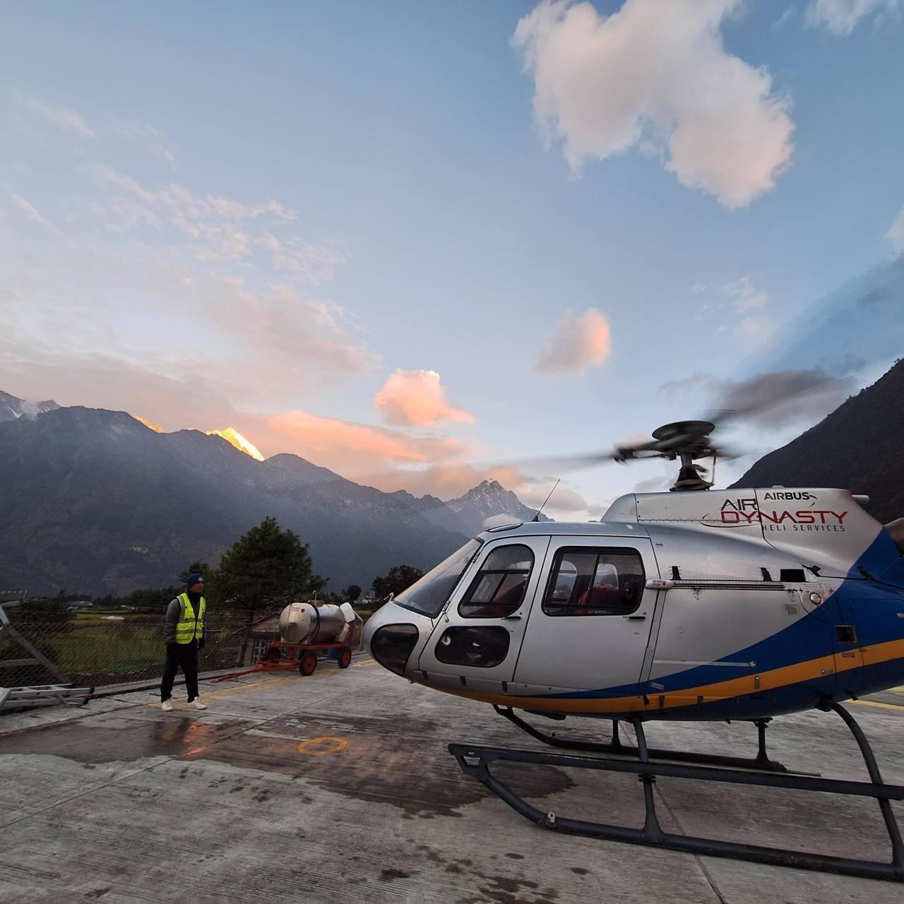
Charter flight via Airbus AS350 B3e helicopter operated by Air Dynasty.
Experienced, CAAN-certified alpine helicopter pilot.
Pheriche shuttle flight fee (if applicable for weight split).
High-altitude medical oxygen allocation on board.
Emergency assistance coordination.
International flight tickets and Nepal entry visa fees, along with Sagarmatha National Park permits and local government entry fees.
Accommodation and meals in Kathmandu.
Personal travel insurance (must cover high-altitude medical evacuation up to 6,000m).
Personal expenses, tipping for crew/pilots, and alcoholic beverages during breakfast.
None specified.
Temperatures drop significantly in the Everest region, so wear a moisture-wicking base layer with a fleece or down jacket and windproof outer shell.
Wear Category 3 or 4 UV-protection sunglasses to reduce glare from snow and ice and improve comfort during the flight.
Bring a fully charged camera or smartphone with spare batteries or a power bank, as cold temperatures can reduce battery performance.
Bring a reusable water bottle and stay well hydrated before and during the tour, while avoiding excessive alcohol before the flight.
Carry a fully charged phone and a compact power bank, keeping both protected from the cold to help preserve battery performance.
We originally signed up for the standard Everest overfly package, but at the last minute, we asked if we could upgrade to the breakfast landing in Kongde instead. Given high-altitude weight restrictions and flight permits, I expected a long 'no' or a bureaucratic nightmare. Instead, their operations team handled the extra permits and payload calculations seamlessly. Sitting at Kongde looking out over the peaks was unbelievable. Huge thanks to the team for making it happen so smoothly!
Direct landings at the official Everest Base Camp (5,364 meters) are legally restricted by the Government of Nepal and CAAN to preserve the environmental integrity of the glacier, prevent acoustic disruption to climbing expeditions, and manage safety hazards on active glacial ice. Instead, our tour executes an active continuous overfly circuit directly above the Khumbu Icefall and EBC at 5,364 meters. This overfly profile provides an unparalleled aerial survey of the tented base camp and high-altitude route topography while maintaining safe forward airspeed, eliminating the logistical and physiological risks of a high-altitude ground landing on an unstable glacial surface.
As air density decreases exponentially with altitude, a helicopter's lifting capacity scales down dramatically. While our Airbus H125 fleet safely transports a full payload of five passengers (approximately 400–450 kg total weight) from Kathmandu to Lukla, it cannot safely hover or land at Kala Patthar (5,545m) with this weight. To comply with strict aerodynamic safety margins, we execute a mandatory weight-shuttle staging protocol at Pheriche (4,371 meters) or Syangboche (3,780 meters). The pilot splits the passenger group, transporting a maximum weight of 220 to 250 kg (typically 2 to 3 passengers) per rotation to the highest observation coordinates, ensuring the turbine retains critical engine power reserves.
The Airbus H125 (formerly AS350 B3e) is specifically engineered to master high-altitude, low-density environments. Driven by a powerful Safran Arriel 2D turboshaft engine with dual-channel FADEC (Full Authority Digital Engine Control), the propulsion system dynamically adjusts the engine parameters to match thin atmospheric pressure. With a structural ceiling limit of 23,000 feet (7,010 meters), the aircraft maintains stable, vibration-dampened flight dynamics even when navigating the turbulent air currents common near Nuptse and Lhotse. Learn more about our specialized fleet deployments via our Helicopter Charter Operations Panel.
Because our overfly tour transitions rapidly through extreme elevations, the pressure drop reduces blood oxygen saturation levels. While the exposure time above 5,000 meters is strictly limited to prevent the onset of severe acute mountain sickness, we carry an active, medical-grade supplemental oxygen system on every flight. In alignment with Airbus high-altitude operations guidance and ICAO Annex 6 standards, our aircraft are equipped with dedicated oxygen tanks, multi-port flow regulators, and individual inhalation masks. Our cockpit crew continuously monitors passenger responses to ensure safe physiological parameters throughout the high-altitude circuit.
Tribhuvan International Airport (TIA) in Kathmandu is heavily prone to morning radiation fog during autumn and winter, which temporarily drops runway visibility below legal Visual Flight Rules (VFR) safety minimums. Helicopter charters cannot launch under instruments if the transit valleys are obscured. To bypass unnecessary delays, our flight dispatch team relies on real-time meteorological data from automatic weather stations installed across the Khumbu valley, as documented by the Bulletin of the American Meteorological Society (BAMS). By comparing real-time wind shear, barometric fluctuations, and cloud ceiling trends, we safely time our departures to align with clear, high-alpine flight windows.
Himalayan micro-climates are highly volatile, and flight paths can be blocked by sudden cloud cover or severe wind shear within minutes. If CAAN flight controllers or our pilots determine that VFR weather minimums cannot be met, the flight is entered into a tactical safety hold or rescheduled. We operate a completely transparent, risk-free booking framework. If your flight is fully compromised by bad weather, your reservation is transitioned to the next clear meteorological window at no extra cost, or you are issued a prompt, hassle-free refund under our safety guarantee. To safeguard your travel plans, we recommend scheduling a 24-to-48-hour buffer window in your broader itinerary.
To ensure our direct charter rates remain entirely transparent, our baseline booking prices exclude localized administrative and land fees. Passengers must settle these fees independently in cash (USD or Nepalese Rupees) at regional terminal checkpoints. These out-of-pocket costs include the Tribhuvan International Airport (TIA) domestic passenger departure tax, the Sagarmatha National Park conservation entry permit, and localized municipal community taxes. Additionally, the optional premium breakfast stop at high-altitude mountain lodges, such as the Hotel Everest View (3,880m), represents an independent, third-party hospitality charge billed directly by the resort operator.
During the active visual corridor of the Everest helicopter overfly tour, the flight path targets an operational altitude ceiling between 5,500 meters and 6,500 meters (18,044 to 21,325 feet) within designated Visual Flight Rules (VFR) mountain corridors. To understand the physics of high-altitude helicopter operations, the Khumbu airspace is divided into precise zones:
Because our overfly profile is continuous and maintains forward airspeed, passengers bypass the high-altitude pressure adaptation risks associated with landing on foot, offering a highly secure vantage point. To review specific routing alternatives across these flight zones, explore our Everest Region Private Charters.
No, commercial helicopters are strictly prohibited from landing on the actual summit of Mount Everest (8,848.86 meters). Although a modified Airbus H125 achieved a singular, legendary experimental landing on the summit in 2005, commercial landing operations at that altitude are physically and aerodynamically impossible due to the lack of atmospheric pressure to generate ground-effect lift. Furthermore, under Civil Aviation Authority of Nepal (CAAN) mandates, no commercial scenic flights are authorized to attempt landings on the summit structure. The highest authorized touchdown point on our tour is the Kala Patthar viewpoint at 5,545 meters (18,192 feet), which is subject to strict load limits.
Yes, structural safety and physiological limits dictate that landings at Kala Patthar (5,545 meters) are strictly capped at 7 to 10 minutes. Because the human body requires days of gradual ascent to adapt to the thin air at this elevation, prolonged exposure without pressurized cabins poses immediate hypoxia risks. This short landing window is mandated under CAAN Flight Operations Safety Directives to protect passenger health. It provides ample time to step onto the terrain, capture high-resolution imagery of the Everest west shoulder, and board the climate-controlled cabin before physiological acclimation symptoms can manifest.
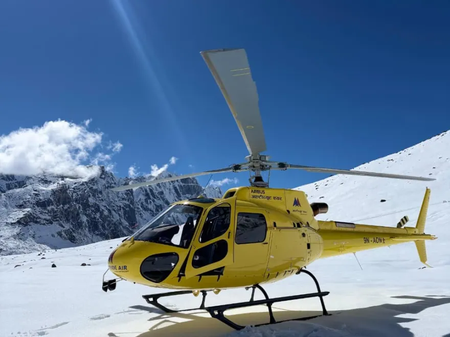
| No of people | Price per person |
|---|---|
| 5 - 5 | $1,600 |
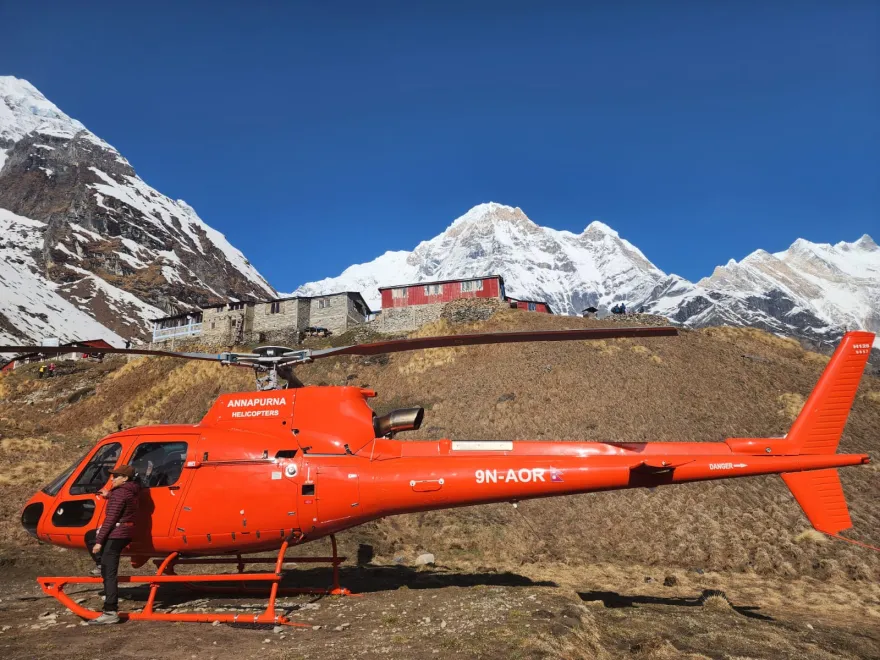
| No of people | Price per person |
|---|---|
| 1 - 4 | $1,350 |